 Holiday Routes
Driving mountain passes: plan range and climbs on the real road
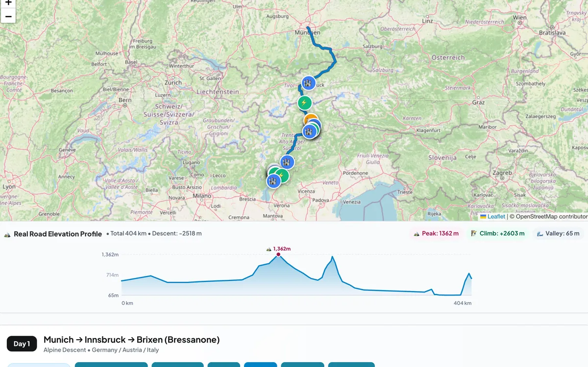
Mountain roads are the most beautiful part of many road trips — and the part where a quick distance estimate is most likely to be wrong. The climb, the hairpins and the slower average speed all change how long a day takes and how much energy the car uses.
Why the straight line lies
A distance measured "as the crow flies" ignores that roads wind around valleys and up passes. In the mountains, the road distance can be far longer than the straight line, and the driving time longer still, because average speeds drop on switchbacks and through villages.
That is why Holiday Routes calculates every day along the actual road — the same kind of route your navigation app would drive — and shows the real distance and driving time for each day.
Climbs cost energy, descents give some back
Driving uphill takes extra energy, and any car — petrol or electric — feels it. Electric cars recover part of that energy on the way down through regenerative braking, but not all of it. Two practical consequences for EV drivers:
- Start a big climb with a healthy battery rather than planning to charge at the top.
- Don't panic at the summit. The long descent on the other side often adds noticeable range back.
See the climb before you drive it
Open the route map and switch on the elevation profile: you get the height along the whole day, with the highest point and the total climb marked. It makes it obvious which days are relaxed valley drives and which cross a high pass.
Plan the mountain days differently
- Shorter distances. 150 km of mountain road can easily take as long as 300 km of motorway.
- Earlier starts in summer, before the traffic and the heat build up on popular passes.
- Check the pass is open. High passes can close for snow outside summer, and some countries require winter tyres or chains in the car in the cold months.
Holiday Routes adds live weather for every stop and mountain-pass advice to the trip, so you can check the day's conditions from the same screen.
Hand the day to your navigation app
When you set off, send the day to Google Maps, Waze or Apple Maps — or download it for your car — and drive the route you planned.
Frequently asked questions
Is the elevation profile available for every day?
Yes, for every driving day of the trip, and for the whole route at once.
Can I see distances and heights in miles and feet?
Yes. Switch the app to imperial units and every distance, height and speed follows.
Plan your next trip with Holiday Routes
Free to start. Build a complete day-by-day plan, then change anything.
Plan your trip free →Keep reading
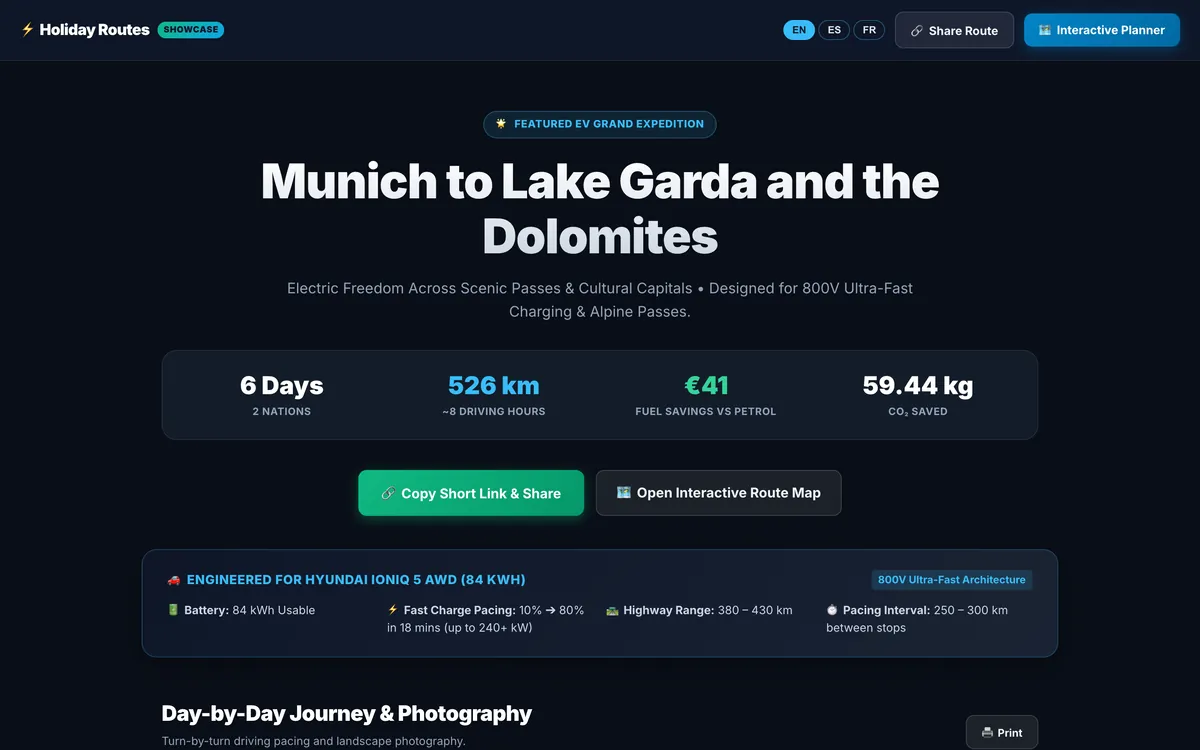
Share your trip as a travel story, with one short link
Turn your itinerary into a travel page with photos, food and stays for every day: one short link that opens on any phone, in English, Spanish or French.
Read the article →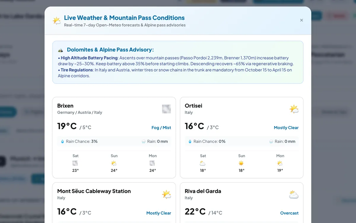
Check the sky before the pass: weather for every stop of your road trip
Live 7-day forecasts for every stop of your road trip, rain chances and temperatures, plus mountain-pass advice for the days that climb.
Read the article →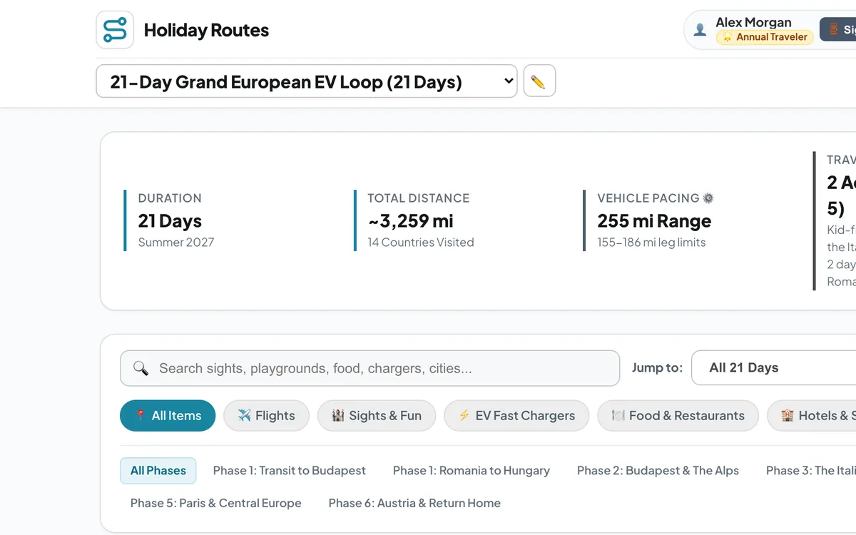
Kilometres or miles: a road trip planner for travellers everywhere
Plan road trips on any continent and switch every distance, climb and speed between metric and imperial units — km or miles, metres or feet, km/h or mph.
Read the article →